Table of Contents Show
Driving the Cassiar Highway can test your nerves and your driving skills. However, travelers can experience the beautiful and rugged terrain of the British Columbia and Yukon territories.
One mistake you don’t want to make is to head out onto this adventure unprepared. If you do, it could be a dangerous and potentially even deadly decision.
Today, we’re sharing some tips for driving the Cassiar Highway so you can conquer this challenging adventure and have an unforgettable experience.
Buckle up, and let’s get started!
What Is the Cassiar Highway?
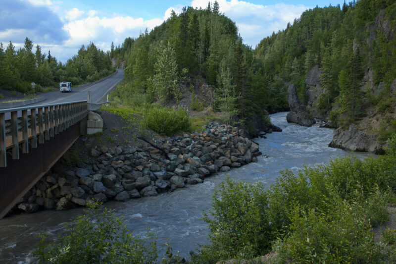
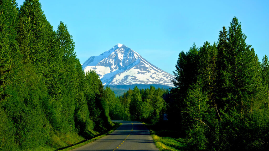
The Cassiar Highway is often nicknamed British Columbia Highway (BC-37). It’s a narrow, two-lane scenic route. It stretches 450 miles and is an alternative to the more famous Alaska Highway.
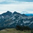
Travelers along this road witness the remote and untouched landscapes of northern British Columbia. You’ll find plenty of opportunities to spot wildlife, take pictures, and enjoy the outdoors.
This road was created due to the demand for mineral exploration in the region. Large quantities of jade and asbestos were discovered in the early 20th century. Construction on these routes began in the 1940s and ended in the 1950s. The original path was a mixture of gravel roads used for mining and logging.
In 1972, construction on Cassiar Highway was finally complete. Aside from a few sections, the road is primarily asphalt. However, as we mentioned, it’s narrower than a standard road. Some of the bridges along the path are one-lane.
Additionally, you’ll encounter large road sections with little to no shoulder. These become issues when meeting wide loads from the logging industry. If you take the proper precautions, you can safely navigate it.
Where Does the Cassiar Highway Start and End?
Cassiar Highway starts near the British Columbia town of Kitwanga. It then travels approximately 450 miles north, eventually combining with the Alaska Highway at Watson Lake in the Yukon Territory.
Travelers can hop on the Alaska Highway to explore the Yukon or continue toward Alaska. Using the Cassiar Highway instead of the Alaska highway helps travelers shave off approximately 130 miles of the trip.
History of the Cassiar Highway
The history of this critical road dates back to the mid-20th century. It played a significant role in developing transportation networks throughout northern Canada. Construction began in the early 1950s to improve access to the rich mineral resources in north British Columbia.
The goal was to connect the Cassiar Asbestos Corporation’s mine in the Cassiar Mountains to the existing infrastructure. The asbestos mine was a significant component of the local economy. However, the construction of this project was challenging.
The remote and rugged terrain presented many challenges. Workers had to navigate dense forests, rocky landscapes, and some of the worst possible weather conditions. However, workers finished in 1972. It continues to make transporting minerals, goods, and people to the Cassiar region possible.
How Much of the Cassiar Highway Is Paved?
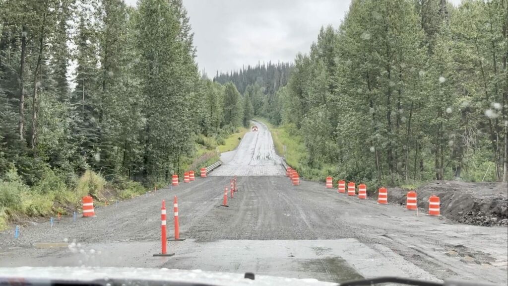
Thankfully, a majority of the Cassiar Highway is pavement. However, you will come across some sections of the path that are gravel or unpaved. These are common in remote and less populated areas along the way.
Like most roads, the Cassiar Highway has some incredibly smooth sections. On the other hand, there are also plenty of dips and bumps in the road. Stay alert and watch for the changes, as they can catch some drivers by surprise.
Tips for Driving the Cassiar Highway
Now that you’re ready to hit the road, let’s look at some of our best tips. These will help ensure you have a safe and uneventful adventure.
Check Road Conditions
As you should with any road trip, check the road conditions before hitting the road. Completing this trip is going to require navigating remote landscapes. Road conditions can change due to weather or maintenance.
For the most accurate and up-to-date information, visit official government resources. By using these resources, you can stay aware of construction and other projects occurring along the way. They’ll update you with insights about hazards, closures, or additional information for your trip. Check these often, especially since cell coverage may only be available occasionally.
Keep in Mind: If you have to drive in foggy conditions, you should always do this!
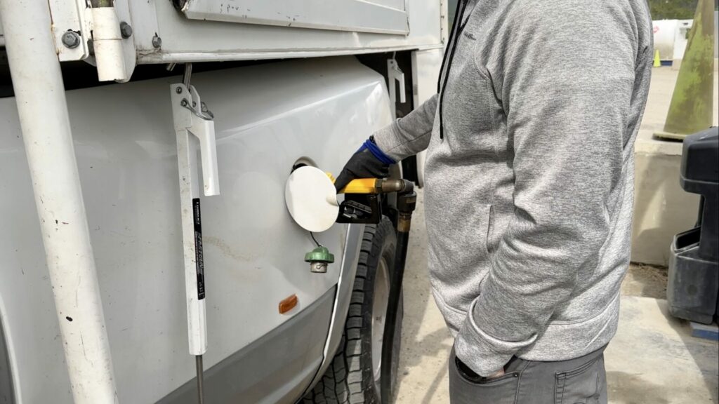
Fuel Up
Whether you drive a gas or diesel vehicle, the last thing you want is to run out of fuel. Unfortunately, fuel stations are few and far between along the road. We encourage you to stop and top off your tank regularly to avoid worrying about running on fumes.
Additionally, plan your stops wisely. Some stations will have limited operating hours or availability. This can make it challenging to depend on them. It’s always wise to have a backup plan. Carry extra fuel containers as a safety net during unexpected circumstances.
Use Pullouts
One of the best features of the Cassiar Highway is the many pullouts along the way. These are fantastic opportunities to get out and enjoy the breathtaking scenery. Because a driver should keep their eyes on the road, these spots can make it possible for them to enjoy the views, too.
We recommend also using these pullouts as an opportunity to enjoy lunch. In our experience, no matter what you’re eating, it tastes better with a gorgeous view. Whether it’s shimmering lakes or snow-capped mountain peaks, take time to enjoy them. You can relax and get some fresh air before returning to the road.
Pro Tip: Wondering how to wash your RV? This Is What You Need To Know
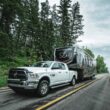
Drive Defensively
As mentioned, this road is narrower than a typical two-lane road. In addition, large trucks hauling wide loads frequent the route. Unfortunately, much of the road lacks guardrails and has deep ditches on both sides.
This means whoever is driving must take extra precautions to stay aware and attentive to the road. There’s very little room for error here.
Being a good defensive driver means driving the speed limit, keeping your distance from others, and expecting the unexpected. You never know when you’ll experience a gravel section, curve, or wildlife in your path.
Additionally, you’ll need to adjust your driving for the weather and road conditions, which can change with little notice.
Take the Side Trips
There’s no award for completing the Cassiar Highway as quickly as possible. As a result, we encourage you to take your time and enjoy a side trip or two. Being able to explore the Canadian wilderness is an adventure. Some great options are to detour to Hyder/Stewart and Telegraph Creek.
You can get off the road and discover hidden treasures by taking side trips. You can spot glaciers and wildlife and hike thick forests. These detours allow you to see more than just the road.
Is Driving the Cassiar Highway Worth It?
The Cassiar Highway is an adventure for anyone who wants to spend time off the beaten path. It’s one trip worth it for anyone heading north into Alaska.
The views of the surrounding landscapes are better than words can describe. Immerse yourself in the adventure and take the opportunity to make unforgettable memories.
Have you traveled the Cassiar Highway? Do you think it’s worth the trip?