


Table of Contents Show
If you enjoy traveling to National Parks and experiencing these stunning landscapes and varied cultures, you have to explore the National Park to Park Highway. The route goes through several states, from Colorado to Washington to Arizona.
It includes stops and detours where travelers can explore twelve National Parks. It’s a great way to wind through the western states while embracing these national treasures. Let’s learn more about this highway!
What Is the National Park to Park Highway?
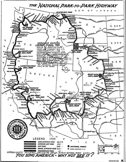
Plotted in the 1910s and 1920s, the National Park to Park Highway is an auto road that connects twelve National Parks in the west.
PBS even produced a documentary about this route, detailing the history of automobiles and auto travel as well as the 5,000-mile journey in 1920 of a group of motorists on this road.
None of these roads were paved, and the weather in these western and Rocky Mountain states made traveling quite difficult in some areas.
Eventually, in 1926, the National Park to Park Highway Association disbanded, and federal-funded and state-funded road-building projects began.
The automobile industry and highway construction have both come a long way since the 1920s.
Today, travelers can drive with ease on paved roads and stop for fuel, snacks, and restroom breaks much more frequently.
Can You Still Drive the National Park to Park Highway?
The almost 6,000 miles of highway are still traveled today. But now, travelers can include other National Parks like Bryce Canyon and Joshua Tree that are located nearby.
It’s not a weekend trip, but it’s a great way to explore the National Parks in the west. You won’t see the history of the highway system today because everything has been modernized.
Today’s travel is much easier, faster, and more convenient than that first trek in 1920.

How Long Is the National Park to Park Highway?
The inaugural tour in 1920 required motorists to be able to travel over 5,000 miles in 76 days.
They stopped in towns along the way to give speeches about the importance of supporting the construction of roads to the National Parks.
They averaged about 65 miles per day.
Today, motorists can average much more than 65 miles. The entire length of the route is over 5,600 miles.
But the time you spend at each National Park determines the length of your adventure.
You could travel for two weeks, stopping every day to enjoy one National Park. Or you could travel for an entire month, spending several days at each location.
When Is the Best Time to Explore the National Park to Park Highway?
The first trip in 1920 started on Aug. 26, 1920, in Denver, Colo. But as they left the Grand Canyon and entered Colorado for the last leg of the journey, the snow became a problem as it was November.
Today, cars and tires are much better equipped to handle wintry weather. So traveling with a 4×4 vehicle in the fall is a great idea.
You’ll want to avoid the winter, as snow covers many of these National Parks and roads. Although spring might be nice weather, you’ll encounter lots of snow melt and still experience snow-covered roads in some states.
The summer months are full of seasonal tourists, so the crowds are much larger. The temperatures can also reach over 100 degrees in the southern California region.
Keep in Mind: We love exploring national parks, but some are worth avoiding in the summer. Before you hit the road, take a look at the Worst National Parks to visit on your summer road trip
National Parks Along the Highway That You’ll See
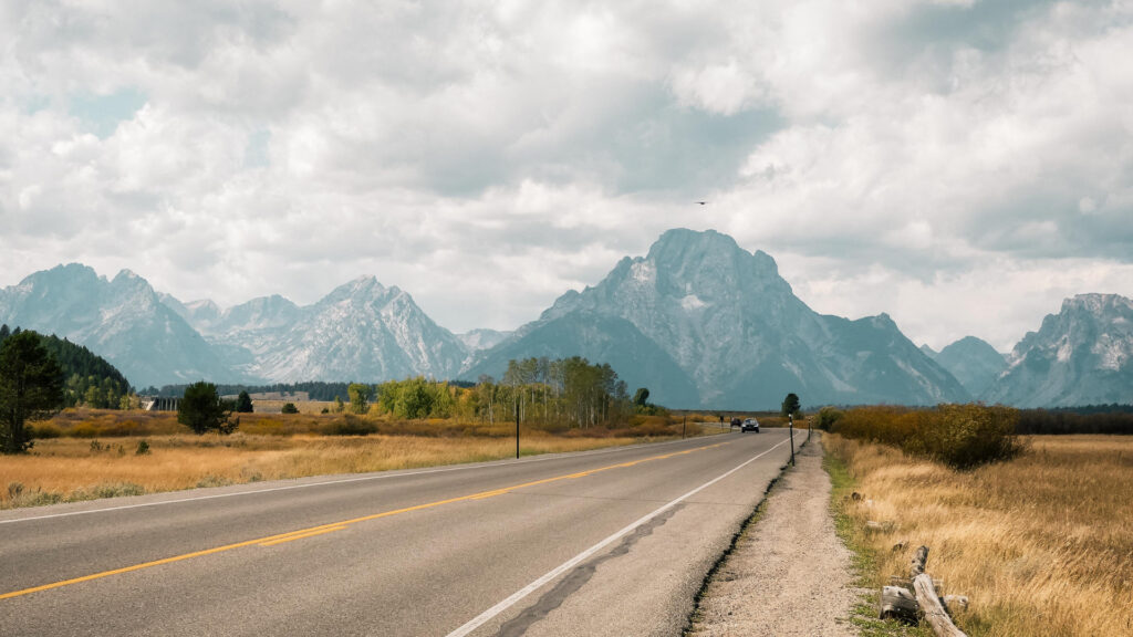
The route officially begins in Denver and heads north and west through Rocky Mountain National Park and Yellowstone National Park. The last National Park on the loop is Mesa Verde in southwestern Colorado.
Rocky Mountain National Park
Less than two hours from Denver, Rocky Mountain National Park is famous for its pristine mountain lakes, jagged rocky peaks, and abundant wildlife such as moose, bighorn sheep, and elk.
Make sure to drive the Trail Ridge Road as it winds 48 miles from Estes Park to Grand Lake.
Its highest point is 12,183 feet, and 11 miles travel above the treeline. If you enjoy hiking, the park has 355 miles of trails ranging from 7,500 to over 12,000 feet.
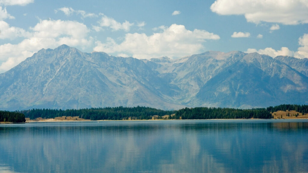
Yellowstone National Park
America’s first National Park, Yellowstone welcomes about four million visitors annually. Canyons, hot springs, geysers, and waterfalls fill the wilderness.
You’ll likely see bears, wolves, bison, elk, and antelope in the 2.2 million acres of Yellowstone National Park.
There are more than 900 miles of hiking trails, many leading to popular spots like Old Faithful, Fishing Bridge, Mammoth Hot Springs, and the Grand Canyon of the Yellowstone.
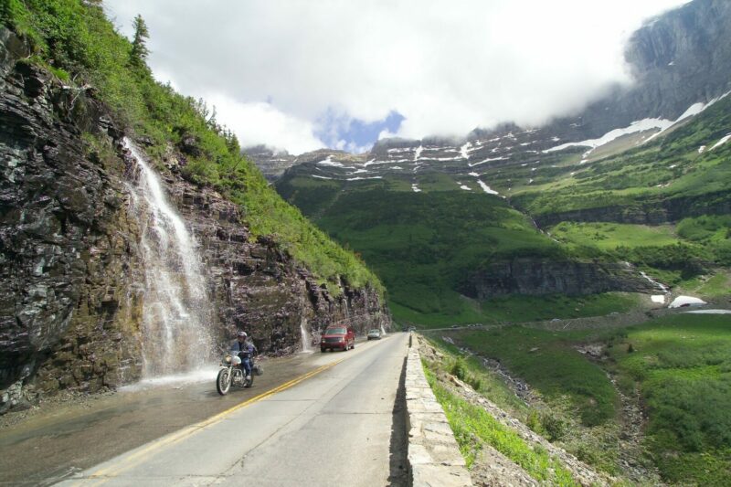
Glacier National Park
Established in 1910, Glacier National Park is one of the northernmost parks in the lower 48. Glacier-carved peaks, lakes, forests, and valleys extend from Montana to the Canadian border.
More than 700 miles of trails run throughout the park, with some of the most popular treks taking hikers to Hidden Lake, Piegan Pass, and Highline Loop.
The 52 miles of the famous Going-To-The-Sun Road run from Saint Mary Lake at the west entrance to the east entrance.
At 6,646 feet, Logan Pass is the highest point.
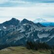
Mt. Rainier National Park
Southeast of Seattle, Mt. Rainier National Park encompasses over 230,000 acres and includes Mount Rainier, an active volcano rising 14,411 feet above sea level. Hikers enjoy over 260 miles of trails throughout the park.
Nature lovers revel in the beautiful wildflower meadows or Paradise and the breathtaking views of Mount Rainier at Sunrise.
Bicycling is very popular in the fall, as bikers appreciate the beauty of the park as well as the challenge of the trails.
Crater Lake National Park
About 7,700 years ago, Native Americans witnessed a thunderous explosion that led to the collapse of a peak that formed Crater Lake, the deepest lake in the country.
The stunning blue waters inspire artists from all over the world to capture its beauty through photographs and paintings.
The 33-mile Rim Drive includes 30 overlooks highlighting different aspects of Crater Lake National Park.
For visitors who want to get closer to the shoreline, Cleetwood Cove Trail is the only legal access to the shore of Crater Lake.
Fishing and swimming are permitted here, but the trail is strenuous and steep and drops 700 feet in about a mile.
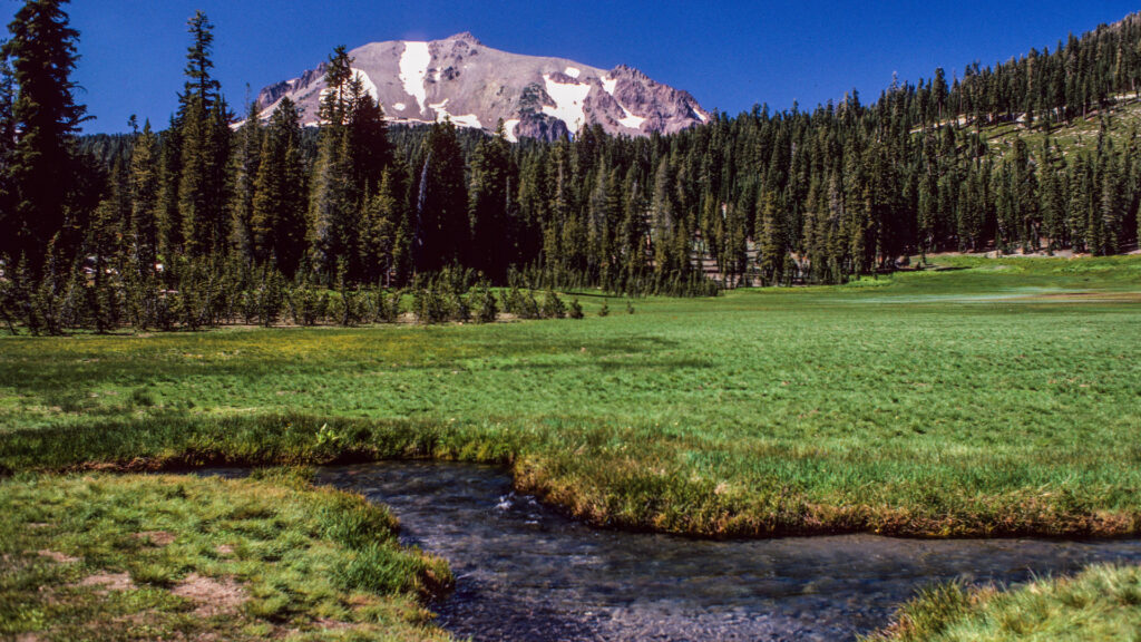
Lassen Volcanic National Park
Lassen Volcanic National Park protects meadows, lakes, and volcanoes in northern California.
For those travelers who enjoy scenic drives, the Lassen Volcanic National Park Highway winds 30 miles around the east side of Lassen Peak to the northwest and southwest entrances of the park.
Guests can visit the unique hydrothermal areas of Bumpass Hell and Sulphur Works.
These areas are called fumaroles, which are steam and volcanic-gas vents.
The Bumpass Hell Trail is a good one to explore the hydrothermal areas of Lassen Volcanic National Park.
Pro Tip: When you stop at Lassen Volcanic National Park, you won’t want to miss out on seeing these unbelievable things at the park!
Yosemite National Park
Known for its stunning waterfalls, Yosemite National Park is home to Yosemite Falls, a 2,425-foot three-tiered waterfall.
It also hosts Bridalveil Falls, a 620-foot waterfall that usually welcomes visitors to the National Park; Sentinel Falls, a 2,000-foot waterfall near Sentinel Rock; and many more.
Glacier Point is a popular overlook with majestic views of Yosemite Valley, Half Dome, and Yosemite Falls.
Hikers and rock climbers enjoy the challenge of getting to the top of Half Dome, the most recognized feature in Yosemite National Park. It rises 5,000 feet above the valley.
Sequoia National Park
Sequoia National Park also includes Kings Canyon, which was General Grant National Park in 1920 when the first travelers took the National Park to Park Highway. The two parks are managed as one today.
The world’s largest trees inspire awe as guests wander through Giant Forest and visit the world’s largest sequoia, the General Sherman Tree.
The General Grant Tree, also known as “The Nation’s Christmas Tree,” is also here. It was dedicated to the Armed Forces in 1956 and is the only living shrine in the United States.
Zion National Park
Located in southwestern Utah, Zion National Park is one of Utah’s “Big Five” and the first traveling from west to east across the state.
Hikers, climbers, and ATV enthusiasts embrace the red rock canyons and sandstone cliffs that make Zion National Park so popular.
The narrowest section of Zion Canyon, the Narrows, has walls extending thousands of feet into the air.
Guests explore the Narrows by walking through the Virgin River.
The Kolob Canyons provide a more tranquil desert setting for hikers who want to escape the crowded Narrows.
Keep in Mind: Fatalities are accumulating daily and some highways are more dangerous than others. Have you Driven the Most Dangerous Highway in the US?
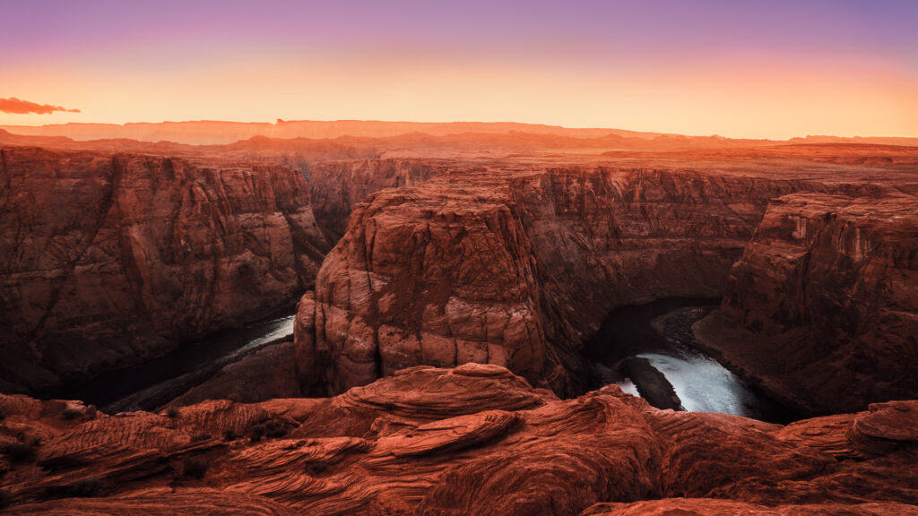
Grand Canyon National Park
One of the most popular National Parks in the country, the Grand Canyon is one of the seven natural wonders of the world.
Its sheer size, with an average of 10 miles between rims, an average depth of one mile, and a length of 278 miles, is difficult to comprehend.
The geologic landscape ranges from Precambrian 1.8 billion-year-old igneous and metamorphic rocks to recent volcanic deposits.
Usually, guests choose to visit either the North Rim or the South Rim because of their great distance from one another.
The South Rim is the most heavily visited area. Bike tours, bus tours, Jeep tours, mule trips, guided hikes, and river rafting trips are all ways to experience the vastness of the Grand Canyon.
Mesa Verde National Park
Unique to the National Park to Park Highway is Mesa Verde National Park, an area that protects old Puebloan cliff dwellings dating back as far as 600 A.D.
Instead of beautiful scenery and challenging hikes, this National Park conserves the history and culture of the Pueblo people.
Petroglyph Point is a popular location as visitors can see petroglyphs, ancient drawings carved into rocks.
The Cliff Palace Overlook on the Cliff Palace Loop Trail offers visitors a fantastic view of the largest cliff dwelling in North America.
Sun Temple on the Mesa Top Loop Trail also has great views. Mesa Verde National Park is a World Heritage Site and International Dark Sky Park.
Should You Visit the National Park to Park Highway?
There’s no easy way to explore all 63 National Parks. From coast to coast and border to border, they’re spread out across the United States. But there is an easy route for travelers to visit several National Parks out west.
Although the National Park to Park Highway only included 12 stops in 1920, now visitors can explore even more parks, National Monuments, National Forests, and more along the way.
You could spend a couple of weeks moving quickly from one location to another or really take your time and spend an entire season along the route.
Have you ever traveled the National Park to Park Highway? If so, how long did you spend embracing America’s national treasures?