
Table of Contents Show
Alberta’s Icefields Parkway and Vancouver Island’s Pacific Rim Highway are two of the most scenic drives in Canada.
But if you venture farther north into the Yukon, you’ll find a remote stretch of highway that travels into Alaska at North America’s most northern international border crossing. The Top of the World Highway is rugged but stunning.
You’ll travel along the crests of mountains the entire way and feel on top of the world. Let’s learn more about this remote highway and what you can do when you visit!
What Is the Top of the World Highway?
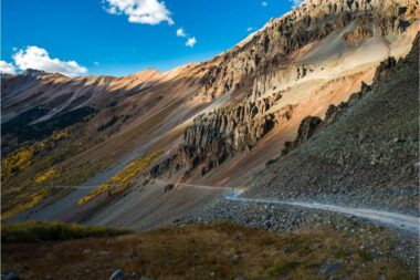
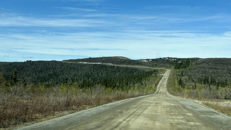
The Top of the World Highway is a 175-mile road that stretches west-to-east from Tetlin Junction, Alaska, to the ferry terminal in West Dawson, Yukon. The Yukon part of the road is also called the Yukon Highway, while the Alaska part is called the Taylor Highway.
So why is it named Top of the World Highway? Along most of the route, the road travels the crest of the hills, providing views down to the valleys. It’s as if you’re really traveling on top of the world. It’s also one of the most northern highways worldwide.
Can You Drive the Top of the World Highway Anytime?
The Top of the World Highway is only open from June to September. A ferry operates on the east end of the highway during the summer and takes residents and visitors from West Dawson to Dawson. In the winter, residents cross the Yukon River on ice.
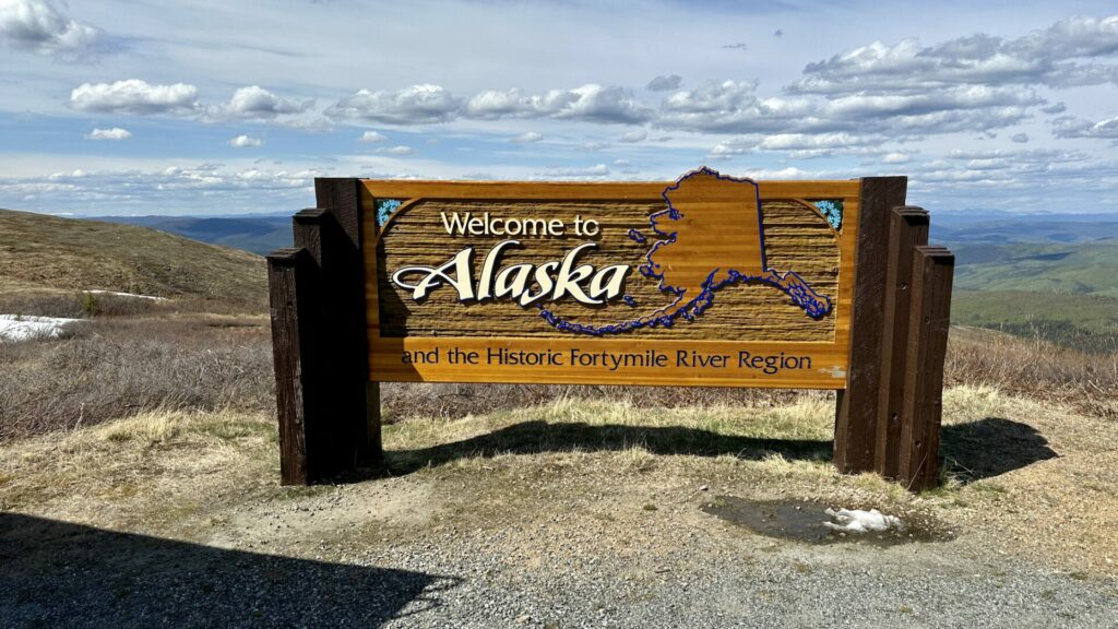
Where Is the Top of the World Highway Border Crossing?
At mile marker 106 is the border between the United States and Canada. The Poker Creek-Little Gold Creek Border Crossing is North America’s most northern international border crossing. You can’t cross overnight. The border closes from 9 p.m. to 9 a.m. Yukon time.
However, there’s a one-hour time difference between Alaska and the Yukon. So it’s important to remember this when traveling along the Top of the World Highway. If coming from Alaska, the border is open during the summer from 8 a.m. to 8 p.m.
Is the Top of the World Highway Paved?
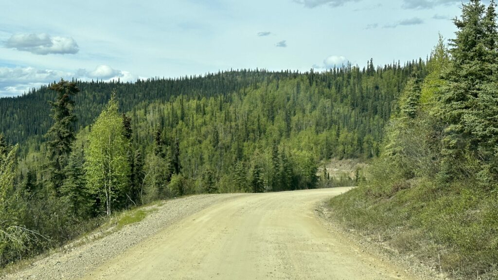
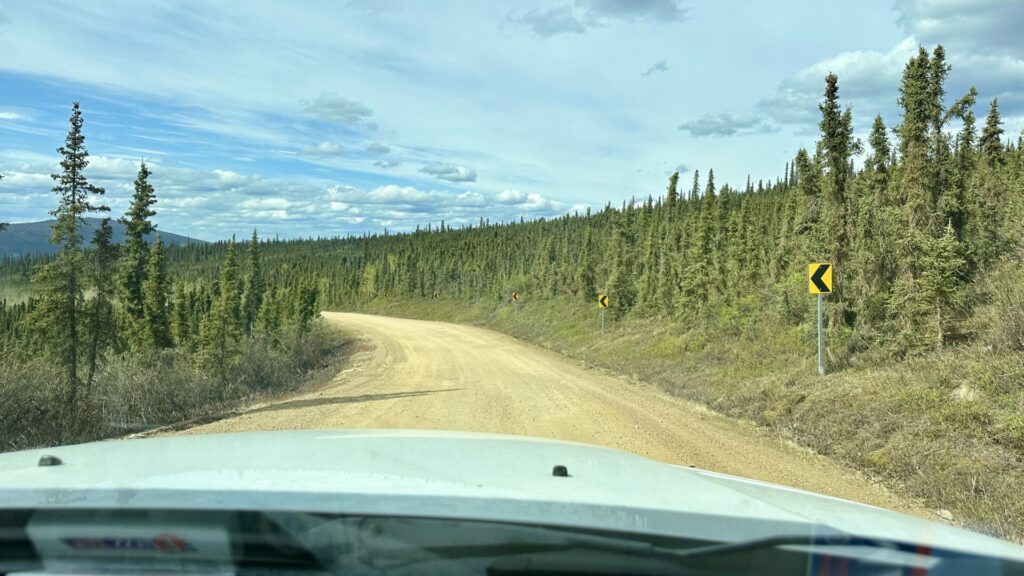
Most of the road in Alaska is paved, while most of the Canadian side is unpaved. This narrow road has lots of potholes and soft shoulders. You must drive slowly along the Top of the World Highway.
The road is paved from the border west about 13 miles to Jack Wade Junction. The spur road from here to Eagle is gravel. The 30-mile Taylor Highway from Jake Wade Junction to Chicken is also unpaved. Once you reach Chicken, the road is in good condition and mostly paved to Tetlin Junction.
The Top of the World Highway has pavement in small sections on the Canadian side. The first 5 miles from Dawson and the last 3 miles at the border crossing are paved. A few additional sections have pavement, but they only last a few miles.
Is the Top of the World Highway Dangerous?
The road isn’t an easy drive. Speeding along the narrow, winding mountain roads increases your risk of getting into an accident or losing control of your vehicle. It has tight turns, soft shoulders, and no guardrails.
But if you drive slowly and with caution, the Top of the World Highway isn’t any more dangerous than other scenic roads.
Also, pay attention to the weather. Rain will make the surface slippery and create washboard roads along the unpaved portions of the highway.
Some rental agencies won’t even allow their vehicles on the Top of the World Highway because of the damage it can cause to the car.
How Long Does It Take to Drive the Top of the World Highway?
If you drive without stopping from West Dawson to Tetline Junction, it’ll take about three and a half hours. However, weather conditions and road conditions can significantly affect your drive.
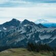
The Top of the World Highway takes you through spectacular scenery, meandering along mountain ridges. Stop to take in the views of the valleys below at the various pull-outs and small towns. Take your time and enjoy the drive.
Things to Do Along the Top of the World Highway
There aren’t many things to do along the Top of the World Highway. It’s remote and rugged. Most people travel this road for scenic beauty, not tourist attractions. But we do have a few suggestions if you want to attempt this drive.
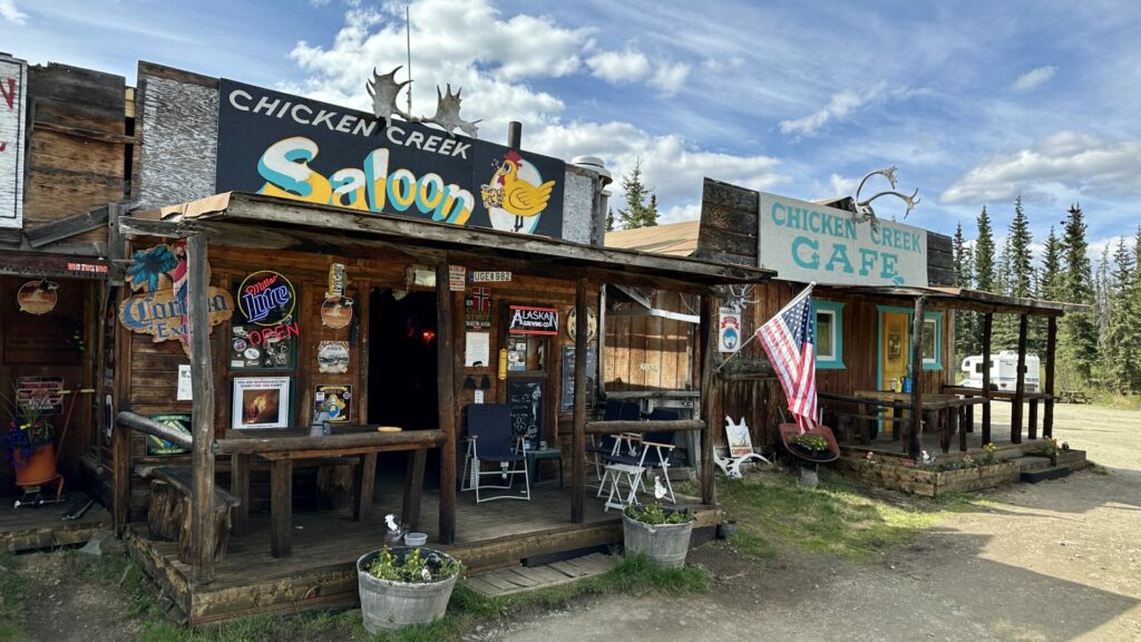
Visit the Chicken Gold Camp Outpost
In Chicken, you’ll have access to amenities not available anywhere else along the Top of the World Highway. Take advantage of the cafe where you can sit down and eat a pastry or pizza. Order an espresso or craft beer.
The gift store has all kinds of souvenirs and locally handmade items like pottery, knives, Native clothing, arts and crafts, and jewelry. You can also find gold mining equipment and gold nuggets.
Take the Taylor Highway to Eagle
At Jack Wade Junction, an unpaved gravel road leads to the town of Eagle. This is where the Taylor Highway skirts north for about 65 miles.
The Eagle Historical Society gives three-hour walking tours in the summer and teaches visitors about the town’s history. In its heyday, Eagle was a booming mining town, and it became the first incorporated city of Interior Alaska in 1901.
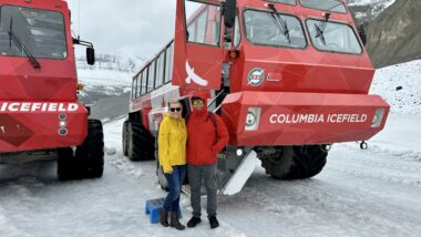
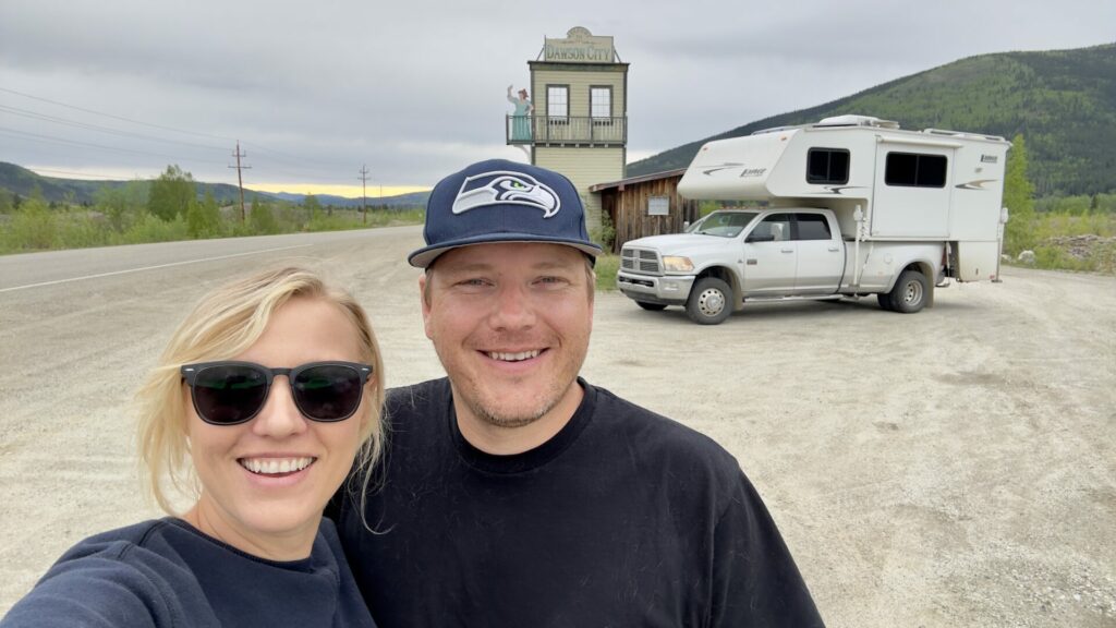
Visit Dawson City, Yukon
West Dawson is where you’ll start or end your drive along the Top of the World Highway. You could spend a couple of days here.
Like Eagle, it’s an old Gold Rush-era town where you can learn more about its history, pan for gold, or paddle down the Yukon River. Parks Canada manages the heritage buildings, so you can see much of how Dawson used to be.
Keep in Mind: Dawson City is home of the Sourtoe Cocktail! Do you have the stomach to try this drink?
Stay Alert for Wildlife
As with any drive in a remote area, stay alert for wildlife. You’re driving in their habitat. Large animals like moose, elk, caribou, and bears live here.
They’ll offer magical moments to watch from a distance but never approach wildlife. Don’t attempt to feed them, either. Take photos, embrace the moment, and enjoy the rest of the drive.
Take Advantage of the Pull-Outs
Although you can drive the Top of the World Highway in less than four hours, you can spend the entire day along this route.
It has numerous overlooks and pull-outs on both the Canadian and Alaskan sides. Stretch your legs, eat a picnic lunch, take photos, and breathe in the fresh mountain air.
Are There Any Highways That Travel Farther North?
Although it’s called the Top of the World Highway, two other highways travel farther north. The Yukon Dempster Highway and Alaska’s Dalton Highway travel to higher latitudes.
The most northern point of the Top of the World Highway is 64.233, just a couple of degrees south of the Arctic Circle at latitude 66.30. However, the Dempster and Dalton Highways travel across the Arctic Circle.
Keep in Mind: America is filled with spectacular drives! These are some of the most scenic routes RVers have ever traveled
Will You Venture as Far North as the Top of the World Highway?
Riding along the winding road of the Top of the World Highway makes you really feel like you’re traveling on top of the world. The valleys seem so far away, and the peaks continue one after another. The breathtaking views are unmatched and may leave you speechless.
But it’s certainly a long way away. The Tetlin Junction, where the Top of the Highway begins in Alaska, is over two hours north of the more populated southern region of the state. It’s about three and a half hours from Fairbanks.
So, if you want to brave the remote and rugged nature of the Top of the World Highway, you can have an unforgettable experience. Just go prepared!