


Table of Contents Show
Thor’s Well is a cool spot to explore if you’re ever traveling along the west coast. Though there are many different places to explore along the west coast, you shouldn’t overlook this stopping point.
It may only take an hour or so to get the full experience here. But wouldn’t you love to know firsthand what Thor’s Well is really all about? Take some time now to dig into a few facts surrounding the history and mystery of the place called Thor’s Well.
What Is Thor’s Well?
Thor’s Well is located along the basalt shoreline of Cape Perpetua. Three miles south of Yachats, the Cape Perpetua Scenic Area is a well-marked overlook spot for the “well.” It’s right off of scenic highway 101.
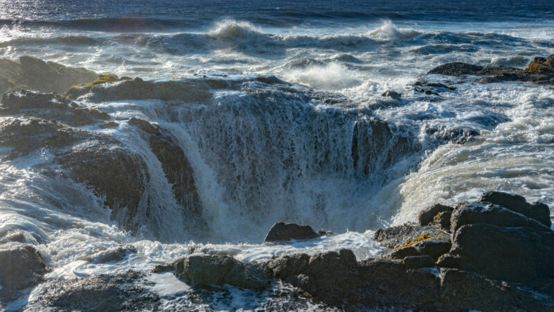
Many once thought Thor’s Well to be a remnant of a huge sinkhole, but time (and more research) has revealed a different picture. Researchers now know that Thor’s Well is actually a collapsed sea cave.
The ocean water slowly formed the cave over thousands of years. That is, until one day, the waves crashed so hard into the sea cave that they finally wore down the top of the cave enough to burst right through. The collapse of the sea cave left a gaping hole in the volcanic rock that makes up the shoreline. Though it looks like Thor’s Well is a never-ending descent, it’s only about 20 feet deep.
Why Is It Called Thor’s Well?
It is speculated that the hole got the name because of the Norse god of thunder, Thor. Stories tell of a time when Thor’s mighty hammer struck the rock, creating the large opening. The rest of the story explaining why Thor might have struck the shore is a mystery, or it’s just impossible to find on the internet. Either way, it’s a cool backstory.
What Is at the Bottom of Thor’s Well?
There’s been a lot of mystery surrounding what’s at the bottom of Thor’s Well for a very long time. However, researchers now know that the bottom of the well is pretty much the same as the top. It’s filled with jagged volcanic rock.
The 20-foot deep hole turns to lead out to open water. Thor’s Well never fills up with water, because it has a large opening that drains the water right back into the Pacific Ocean. The simplest solution turned out to be the truth when this mystery finally unraveled.
Keep in Mind: Are the Washington National Parks actually Worth Visiting? Let’s find out!
When Is the Best Time to Visit Thor’s Well?
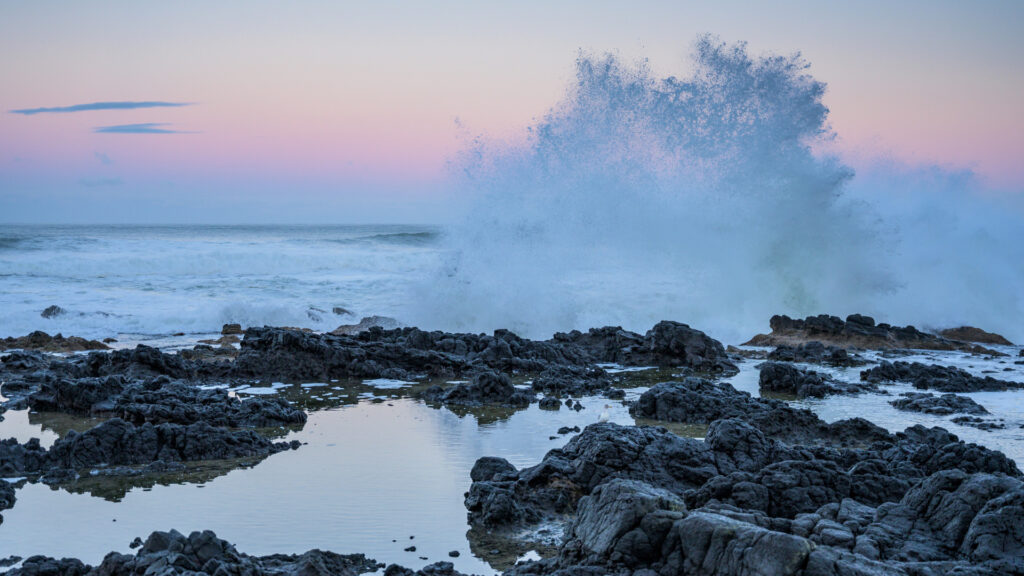
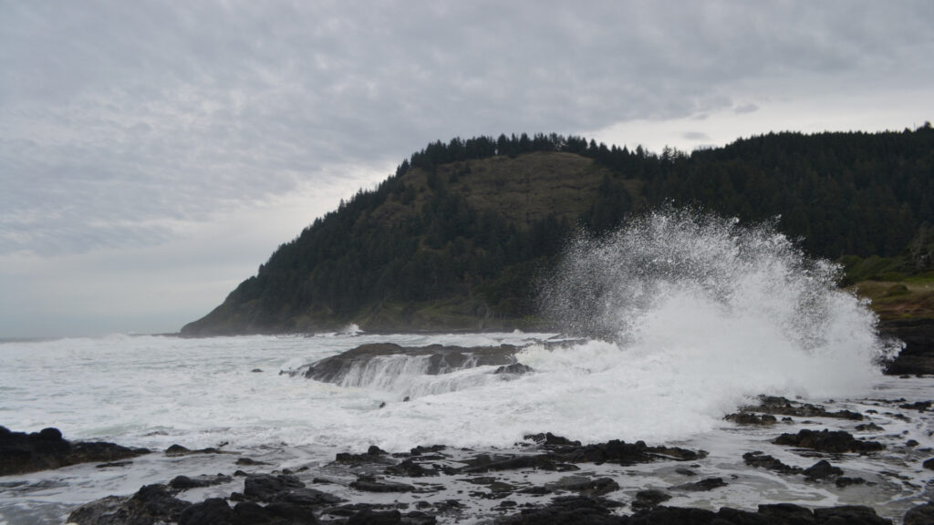
Anytime is really the best time to visit Thor’s Well. Whether it’s low or high tide, the formations of the volcanic shoreline are incredible to see. Photographers have captured the power and danger of this giant hole from all angles and at all times of the day.
If you want to see the peak of the spray when the tide comes into the shore, visit the “well” about an hour before high tide. When the waves bring water rushing into the cave, it looks like the ocean erupts from Thor’s Well. The water can reach up to 40 feet high!
How Do You Get to Thor’s Well?
Once you find the small parking area off of Scenic Highway 101, there’s a short trail leading down to the viewing area. It’ll only take a few minutes to reach a concrete observation spot with stairs that lead closer to the “well.” Once you go down the stairs, the path you choose is your own.
You should practice extreme caution, as the volcanic rock is very sharp, and a fall will likely result in some cuts. You should also be careful not to get too close to Thor’s Well while exploring. The water coming in from the Pacific Ocean is powerful, and a rogue wave can take you off your feet in an instant. There are no protective rails set up to keep you safe. You have to use good judgment.
What Is There to Do Near Thor’s Well?
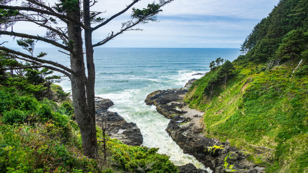
Though Thor’s Well is definitely cool enough to call for its own stop along your travel path, it’s not the only cool thing to see in the area. Here are a few other things you could explore.
Cape Perpetua Scenic Area
The Cape Perpetua Overlook is a definite add-on if you’re stopping your road trip to check out Thor’s Well. It’s only a short six-minute drive from the “well.” The Cape Perpetua Overlook is the highest point accessible by car in all of Oregon. More than 2,600 feet above sea level, the overlook gives you a great view of the headlands below.
Devil’s Churn
Only a mile away from Thor’s Well is Devil’s Churn. It’s in the Siuslaw National Forest. If you thought Thor’s Well shot water high into the air, you’ll love Devil’s Churn. It’s a narrow inlet on the rocky coast that results in water spray that can reach several hundred feet into the air during a rough high tide. You can get to Devil’s Churn by using the Restless Waters Trail.
Pro Tip: While you’re visiting Thor’s Well, stay at one of these Top 10 Highest Rated Oregon Coast RV Parks!
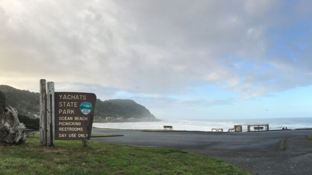
Yachats State Park
If you go a few miles north of Thor’s Hammer, you’ll find a little seaside town called Yachats. It’s rich with Native American history and the home of the famous Heceta Head Lighthouse. You can also get a tasty fresh seafood meal in town.
Witness Thor’s Power at Thor’s Well
Now that you know about Thor’s Well, a trip down the west coast might prove a little more interesting. Add Thor’s Well to your itinerary, and make sure you wear your hiking shoes. Get out and explore the surrounding geography. Soak up all this display of nature has to offer.
When will your next western excursion begin?