Table of Contents Show
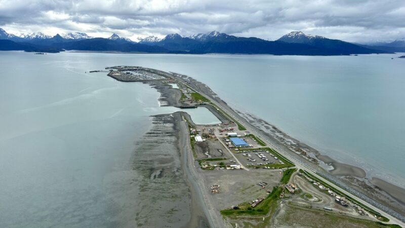
Have you ever heard of a spit? We’re not talking about the saliva in your mouth. It’s a unique landform formed by erosion, water currents, and land angles.
Today, we’ll introduce you to the Homer Spit in Alaska. It’s not a must-see on your road trip, but it’s a cool feature that might be worth exploring if you’re in the area. Let’s dive in!
What Is a Spit?
A spit is a landform formed off coasts or shores. The water currents, angles, and drifts move sediment around, creating new land. A spit often forms at a cove’s headlands because of the currents moving through the cove and depositing sand at the opening.
Vegetation then grows, salt marshes develop, and erosion continues to form and shape the land. The two longest spits in the world are the Arabat Spit in the Sea of Azov and the Younghusband Peninsula in South Australia, which are both 68 miles long.
Is a Spit the Same as a Peninsula?
A spit is a long, narrow shoal extending from the shore to the sea. A peninsula will have a similar shape but is a larger piece of land.
Since a spit is almost entirely surrounded by water, it’s technically a peninsula. But not all peninsulas are spits. For example, Florida is a peninsula but not a spit. It’s much too big.
Where Is the Homer Spit?
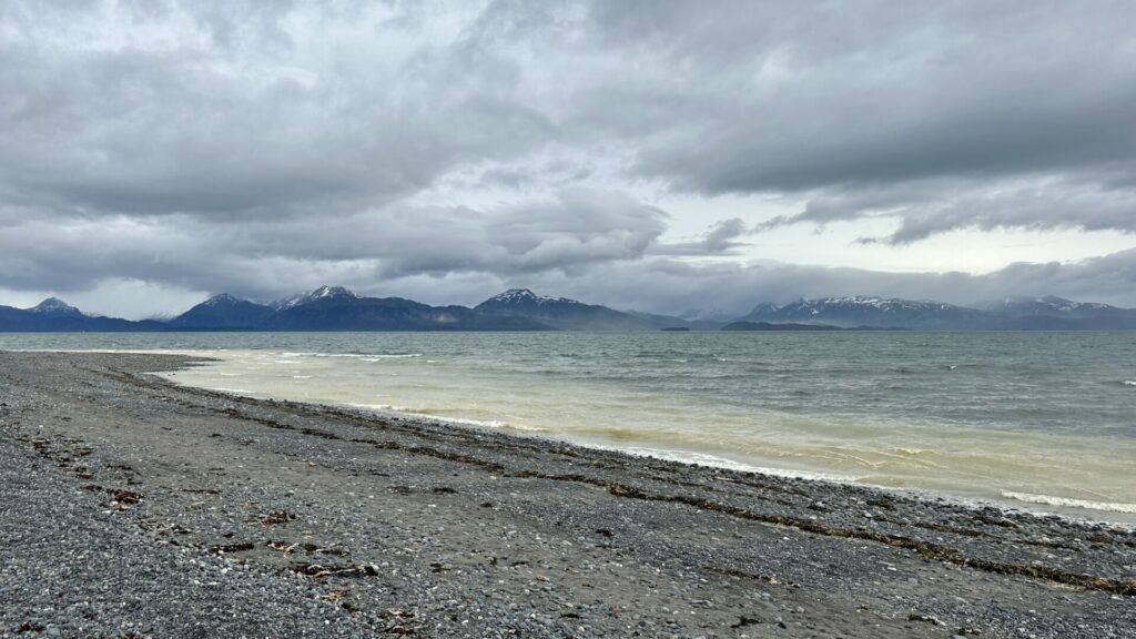
The Homer Spit in Homer, Alaska, sits on the southern tip of the Kenai Peninsula. Highway 1 runs to the end of it, which juts out into Kachemak Bay. The city of Homer sits along the shoreline, about 218 miles southwest of Anchorage.
How Big Is Homer Spit?
The Homer Spit is 4.5 miles long. Compared to the 68-mile-long Arabat Spit or Younghusband Peninsula, the Homer Spit barely appears on a map. However, it features the longest road into ocean waters in the world. Traveling by car takes about 10 to 15 minutes to get to the end of Homer Spit.
But the Homer Spit wasn’t always so small. The 1964 Alaska earthquake, also known as the Great Alaskan earthquake and the Good Friday earthquake, shrunk it to the size it is today, about 508 acres, and killed most of the vegetation. Sadly, the collapsing structures and resulting tsunamis caused about 131 deaths.
The city of Homer has about 5,500 residents. It has 25.5 square miles — 15 square miles of land and 10.5 square miles of water. The Homer Boat Harbor is an important part of life here.
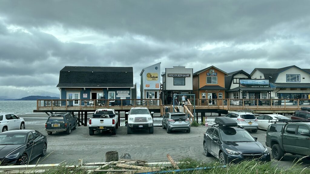
Other notable places to visit include the Nick Dudiak Fishing Lagoon and the Salty Dog Saloon. The local economy thrives on tourism, and the spit has many businesses and recreational opportunities that cater to visitors.
Keep in Mind: While in Alaska, you don’t want to miss the Turnagain Arm Drive!
Why Is It Called Homer Spit?
There’s no special story or mysterious legend surrounding the naming of the Homer Spit. Homer Pennock was a promoter for the Alaska Gold Mining Company.
He arrived in the community, along with about 50 other people, in the late 1890s. Prospectors heading to Hope would leave from the Homer Spit. So, when a post office was established, the company chose to name it after Homer Pennock.

What Dangers Threaten Homer Spit?
Unfortunately, spits are constantly threatened by nature. Because the Homer Spit is only about 19 feet above sea level, it’s susceptible to storm surge and flooding.
Tsunamis also threaten to destroy the shoal. Even the constant pounding of the heavy waves against the shoreline causes continual erosion, leading to the spit’s eventual destruction.
Keep in Mind: While in Hope, Alaska, we were lucky enough to see a bore tide in Alaska along the Turnagain Arm. Here’s how you can see it too!
Are There Other Spits Around the World?
As already mentioned, there are other spits around the world. Long Point, Ontario, has the longest spit in a freshwater body of water. It extends about 20 miles into Lake Erie.
The Farewell Spit, the longest spit in New Zealand, is also 20 miles long and stretches out into the Golden Bay, an arm of the Tasman Sea. Other spits like Spurn Point and Chesil Beach exist in the United Kingdom.
There are about 15 spits in the United States. Alaska even has another in Kotzebue. Washington is home to the longest natural sand spit in the United States, Dungeness Spit, which juts about five miles into the Strait of Juan de Fuca. Interestingly, this landform continues to grow each year.
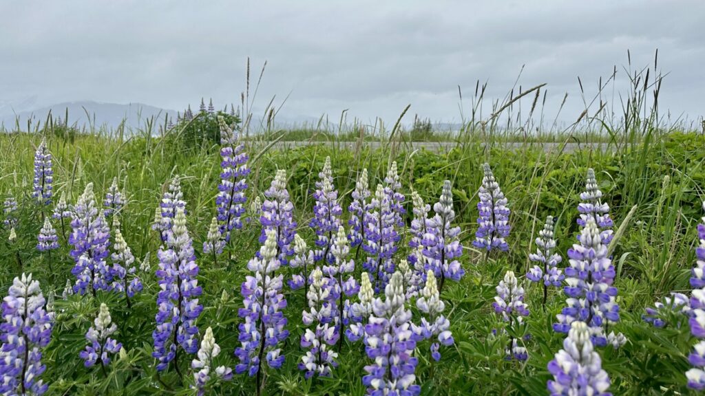
Another Unique Landform in Alaska: The Homer Spit
Alaska is a place of stunning beauty. From glaciers and lakes to valleys and mountains, the Last Frontier is full of spectacular wilderness.
Although the Homer Spit doesn’t compare to the majesty of the icebergs at Glacier Bay or the peaks of Denali, you can still enjoy the beauty of this unique piece of land.
So, the next time you visit Kenai Peninsula, take a drive down to Homer. Spend 45 to 60 minutes driving to the end of the Homer Spit and back, stopping along the way at the various local businesses that cater to tourists. Then you can say you traveled the longest road into ocean waters in the world!
For more information about our favorite stops in the Kenai Peninsula, check out our article “Must Visit Towns on the Kenai Peninsula.”


